Who We Are
Our Mission
The COSMIC Program provides innovative and cost-effective remote sensing observations, data products, and data utilization support, focusing primarily on Global Navigation Satellite Systems (GNSS), to benefit scientific research, research to operations, operations, and education and training in the atmospheric and related sciences.
Our Program
The UCAR COSMIC Program has been a leader in the retrieval and scientific application of GNSS, e.g. GPS, data since UCAR led the GPS/MET GPS radio occultation (RO) mission in the mid 1990s. It contributed to the design, management, and operation of the Constellation Observing System for Meteorology Ionosphere and Climate / FORMOSAT-3 (COSMIC-1) mission from 2006 to 2020. The mission is still providing high-quality RO profiles that are having a significant positive impact on weather and space weather forecasting and research. The success of COSMIC has prompted U.S. agencies (led by NOAA) and Taiwan's National Space Organization to execute a COSMIC follow-on operational mission called COSMIC-2/FORMOSAT-7 (COSMIC-2) that places six satellites with next generation GNSS RO payloads into low Earth orbit.
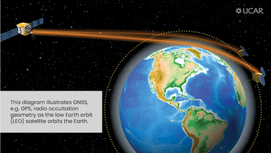
What is GNSS Radio Occultation (GNSS-RO)?
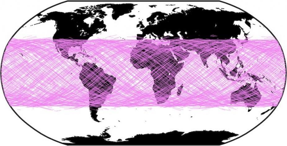
GNSS-RO is a satellite remote sensing technique that uses GNSS measurements received by a low-Earth orbiting satellite to profile the Earth's atmosphere and ionosphere with high vertical resolution and global coverage. The expected daily geographic coverage of COSMIC-2 is shown below. The operational COSMIC-2 Data Processing Center at UCAR will process raw COSMIC-2 data and disseminate environmental data records to the operational and research communities in near real-time.
What Research Can be Performed with GNSS-RO?
The high accuracy and vertical resolution of GNSS-RO data make them ideally suited to study:
- Weather forecasting and atmospheric processes
- Climate monitoring and model verification
- Space weather and ionospheric research

What is GNSS Reflectometry (GNSS-R)?
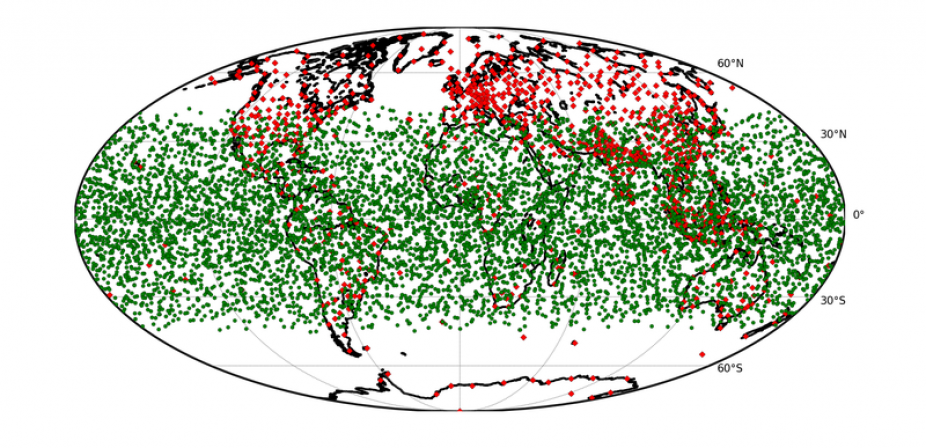
GNSS Reflectometry, i.e. GNSS-R, is a satellite remote sensing technique that uses surface reflected GNSS signals (such as the widely used GPS constellation) to infer information about the Earth's surface. The reflected GNSS signals act as a bi-static remote sensing radar with the reflected signal power responding to changing surface conditions. Reflected GNSS signals can be received on-board a low Earth orbiting satellite and used to estimate environmental conditions over ocean, land and sea ice.
The NASA CYGNSS eight satellite constellation and the UK TechDemoSat-1 satellite both carry GNSS-R receivers capable of making ocean, land and ice observations, which are available to the public.